How it works
From GPX to terrain
Four simple steps between the route you recorded and a model you can put on the shelf.
- 01
Send your route
Share the GPX file from your watch, bike computer or app — Garmin, Strava, Komoot and the like. Tell us the title you'd like and confirm your route statistics: distance, moving time, total elevation and date.
- 02
Choose your style
We’ll send you a set of proof images of your route so you can choose satellite imagery or another map style before printing.
- 03
We design & print
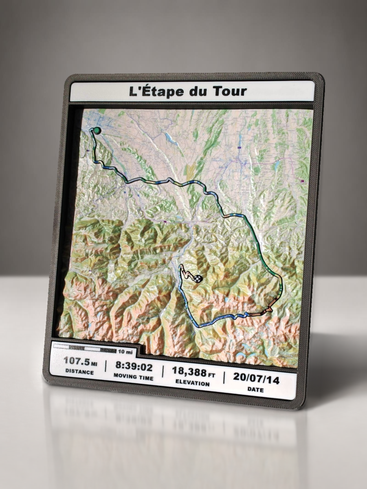
Built from real elevation data, with enhanced relief for very flat landscapes and a 1:1 height scale for naturally undulating or mountainous terrain. Your path is added, coloured by incline and printed in full colour.
- 04
Frame & deliver
Finished in its frame with route stats and a scale bar, ready to stand on a shelf or hang on the wall.
Reading the path
Colour by gradient
The route is lifted slightly off the surface so you can trace it with a finger. It changes colour in clean steps, one solid block for each gradient band, so the hardest climbs jump out instantly.
Questions
Good to know
Made to order
Turn your route into something you can hold.
Every model is made to order. Start your order on Etsy, or follow along on Instagram to see the latest builds.
sales@gpxterrainstudio.com